
Locate Cottage Grove Neighbors by Block
A block search starts with geographic records. Washington County’s parcel map can show which parcels border or sit near an address, while the property search supplies the PIN and limited tax-card context for one parcel at a time. Recorded plats explain lots, blocks, easements, and common areas. City agendas and project pages may show why a road, sidewalk, or subdivision appears in public documents. Each source identifies land, a record, or a civic topic, not a complete current household.
| Source | What it shows about a block | Access |
|---|---|---|
| Washington County ArcGIS map | Parcel boundaries, address points, roads, and adjacent land context. | Free address or PIN map search. |
| County tax and parcel card | PIN, situs, tax fields, and displayed owner or mailing information for one parcel. | Public property search or county contact. |
| Recorded plat or deed | Lot, block, easement, subdivision, common-area, and dated title context. | Recorder index, research room, or copy route. |
| City permits and agendas | Public construction, planning, road, or meeting records connected to an area. | ePermit, Agenda Center, or targeted request. |
| Poll Finder and voter-list process | Election geography at an address; controlled voter data has separate rules. | Official poll tool or statutory request process. |
| Telephone books and local newspapers | Dated historical block clues, subject to gaps and source context. | MNHS, library, historical society, or archive. |
Owners and occupants must remain separate. A parcel can be a park, road, stormwater area, common area, business, undeveloped tract, or multi-unit property. A tax mailing address may be elsewhere, and one name in a land record can be a trust, entity, estate, or title party. Use the map to understand place, then ask the official custodian for a specific public record if one is needed.
Cottage Grove Neighbors Parcel Process
For the immediate block, move outward from the known address in a controlled sequence. The Washington County ArcGIS viewer supports address and PIN searching and provides tax-parcel, address-point, and road-centerline context. The process should stop at the boundaries and record fields that the source actually displays. It should not turn neighboring parcels into a resident roster.
- Find the starting address or PIN on the map and confirm its parcel outline against the county property-search result.
- Select the starting parcel, then inspect each bordering parcel or nearby road feature individually. Note a PIN, address point, parcel geometry, and whether the land appears to be a road, park, common area, or separate lot.
- Check a neighboring PIN in the Washington County property search. Keep situs address, displayed owner or taxpayer, and any mailing detail in separate columns of research notes.
- Where a boundary or shared space matters, consult the recorded plat or legal description through the Recorder. For a full named-street chain rather than one block, use the Cottage Grove street directory record workflow.
This is a geographic process flow: address to PIN, PIN to parcel, parcel to surrounding boundaries, and boundary to the particular official record. It provides a repeatable way to investigate a driveway, lot line, common area, or project address without guessing who occupies any property.
Cottage Grove Neighbor GIS Boundaries
GIS layers are especially useful where the block does not follow a simple row of detached parcels. Tax-parcel, address-point, and road-centerline layers can show an intervening road, water feature, park parcel, or shared tract. Available Assessor, Land Records, Recorder, and Surveyor layers add source context. The map can also reveal that a townhouse development or multi-address parcel needs a plat or city record before it can be described accurately.
Do not use map proximity as a claim about a relationship or residence. A visible address point only locates an address. Parcel adjacency only identifies land beside land. If the question concerns a boundary, easement, private street, or common area, the recorded plat is more authoritative than an informal neighborhood label. Cottage Grove code and subdivision materials may require association-related documents in some private-street or open-space contexts, but no comprehensive official association directory was located.
Cottage Grove Neighborhood Civic Channels
Official city channels can help a resident find a meeting, project, or community-contact route without claiming a private membership list. The city documents homeowner and neighborhood associations as eligible users of City Hall meeting rooms. It also operates Block Parties and Night to Unite as neighborhood participation channels. These are useful places to check a public notice, event, or application process. They are not a directory of all associations or all people on a block.
| Channel or search term | Official contact route | What it can establish |
|---|---|---|
| City Hall association meetings | City meeting-room eligibility and Agenda Center materials. | An official association interface or meeting record, not a membership roster. |
| Still Ponds Park Neighborhood Meeting | City calendar and related agenda materials. | A named neighborhood meeting clue for targeted public-document research. |
| Block Parties | Cottage Grove Block Parties. | Community-coordination route for eligible low-volume streets, courts, or cul-de-sacs. |
| Night to Unite | Cottage Grove Night to Unite. | Neighborhood registration and city public-safety contact, not attendee information. |
When a specific association name is needed, search the city Agenda Center, plat records, and city-code or planning material by subdivision and date. A focused request for public meeting packets, permit numbers, or a recorded plat is more likely to be answerable than a request for a directory that the city does not publish.
Cottage Grove Project Records by Block
Local project names can be valuable search terms because they connect a block to a public agenda, street notice, plat, or permit trail. The city’s 2026 pavement-management materials name Woodridge Park Addition and Pinetree Pond Townhouses, along with Cottage Grove Commercial Addition. The public meeting schedule listed December 1, 2025, January 7, 2026, and May 18, 2026. Those names and dates help narrow an official search, but they do not identify the people connected to a property.
The Cottage Grove pavement-management project page shows the city’s project-record entry point.
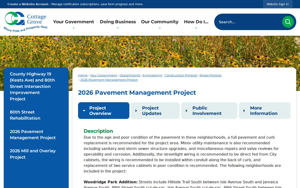
Use a project label with the address, subdivision, or date range in the Agenda Center or a targeted city request. Project notices can explain a public improvement or meeting sequence, while parcel and title sources remain the proper tools for land questions.
Cottage Grove Neighbor Sources Compared
Official records and commercial neighbor-lookup categories are built for different purposes. Official records identify the custodian, record type, date, and access limits. A paid address-profile category may merge information from many sources, but it does not replace the parcel, plat, or city record and may not describe the same time period. For block questions, the official source is the place to verify the land or civic document behind a claim.
| Source category | Best use | Key limit |
|---|---|---|
| Official parcel, tax, plat, or deed record | Verify a particular parcel, legal description, title event, or map boundary. | Owner, mailing data, and title roles do not establish current occupancy. |
| Official city agenda, permit, or project record | Check a dated public action, meeting packet, or development reference. | A name or address in a document needs its record context. |
| Commercial neighbor-lookup category | At most, a prompt to verify a specific claim with a custodian. | May be incomplete, mixed-date, or inaccurate, and should not be treated as an official block record. |
Historical sources offer a fourth kind of evidence. Telephone books, newspapers, maps, and cemetery or biographical files can show a past local connection, but each has date gaps and coverage limits. Do not carry a historical listing forward to describe present neighbors.
Cottage Grove Neighbor Voter Data
The official Poll Finder uses an address to return a polling place and election-district information. It does not reveal who lives there. Minnesota has no verified public name-only Cottage Grove voter lookup. County Elections and the state registration form can assist with election administration, but neither is a public block roster.
Under Minnesota Statutes section 201.091, voter-list access has a permitted-use statement and separate request process. The full list cannot be posted online in searchable form, sold, loaned, or surrendered. Protected voters may obtain withholding, and Safe at Home participants use an alternate address system. Do not infer that an absent, withheld, or alternate record means a person has moved.
Note: Election geography can explain which districts serve a block, but it cannot be used to build a directory of your neighbors.
Cottage Grove Neighbor Privacy Limits
Some information around a block is intentionally not public. Safe at Home participants use an address-confidentiality program, and a protected voter may have withholding under Minnesota law. Court records can be sealed or otherwise nonpublic. City and county custodians classify records by type, and public information must not be stretched into a new list of occupants. An address that is missing, alternate, or unclear should remain unresolved.
The Minnesota Government Data Practices Act supports requests for identifiable public government data while preserving classification limits. Ask for a dated permit, public agenda packet, recorded plat, parcel, or project notice. If an office denies a request, the denial should identify its legal authority. Do not ask staff to assemble every person connected with a street segment or subdivision.
Lawful use. Use block records for personal, lawful research, civic questions, and property context. Never use maps, records, or community channels to stalk, harass, threaten, or bypass a confidential address.