
Trace Cottage Grove Street Directory
Begin with one normalized address, not a name list. Cottage Grove and Washington County use different address formats for different systems, so retain the form that produces a match. The county property search is the starting point for an address, parcel identification number, tax fields, and the displayed owner or taxpayer. That is an ownership and parcel lead, not proof of present occupancy. A trust, entity, estate, or off-site mailing recipient can appear on the record.
Follow the parcel through map and land-record sources in order. Each result should be dated and kept separate from any historical directory or city document. This method avoids treating a map label, a permit applicant, or a recorded grantee as a current household match.
- Enter the house number and street name in the Washington County property search. Omit the street type, direction, and unit when using its address mode, then record the returned PIN and situs address.
- Search the PIN or address in the Washington County ArcGIS map. Compare the address point, parcel boundary, road centerline, and nearby lots before drawing any conclusion about a street segment.
- Use the parcel’s legal description or PIN to frame a recorder inquiry. The legal description ties a recorded instrument to land more reliably than a similar street name.
- Use RecordEASE for the post-login grantor, grantee, date, and legal-description trail. Record the document number, recording date, parties, and instrument type as dated ownership evidence.
- For an older address history, continue with the Recorder research room, plats, local newspapers, and telephone-directory holdings. A failed online search before the recorder’s stated online period is not evidence that no earlier deed exists.
Note: A street-by-street search can establish parcel and record context, but it does not create a verified list of current residents.
Cottage Grove Street Directory Tax Search
Washington County’s public tax and property search accepts either a PIN or a property address. In address mode, the county’s instruction is deliberately short: use the number and street name, such as a numbered street name without adding its type. A matching result can lead to a statement and can show property ID, estimated market value, classification, taxes, districts, and displayed ownership or mailing fields. The portal does not state a complete coverage range, so treat every result as current portal data with an inspection date.
| Search field | How to enter it | What the result supports |
|---|---|---|
| PIN | Use the parcel identification number, such as the county’s dotted PIN format. | Links the selected parcel to tax and statement information. |
| House number | Enter the street number when using address mode. | Narrows the property-address match. |
| Street name | Enter the name without Street, Avenue, direction, or unit. | Finds candidate parcel results for review. |
| Search | Select the portal search control after choosing one mode. | Returns matching property or PIN results, not a name-only lookup. |
A single street must be checked one address at a time. Do not collapse separate units, several parcels, or a common parcel into one household. The county property card can be compared with the map, but its mailing detail may be for a tax recipient elsewhere. A property’s market value is an assessment field, not a sale price or a statement about who is present at the address.
Cottage Grove GIS Street Layers
The county map is the street-context step between tax information and recorded land documents. Its address and PIN search can center the display on a parcel. Turn on tax parcels, address points, and road centerlines, then inspect available Assessor, Land Records, Recorder, and Surveyor layers. Parcel shape, adjoining boundaries, a road name, and a plat reference help identify the right land record when a street has a similar name, new construction, or more than one address.
Map boundaries do not show household membership. Roads, parks, common areas, undeveloped land, and multi-unit parcels can sit between two street addresses. Compare the GIS display against the tax card and a recorded plat before calling two properties adjacent. County GIS data comes from several county departments, and the map is a JavaScript application, so visible controls and layers should be checked at the time of research.
Cottage Grove Deed Trail by Address
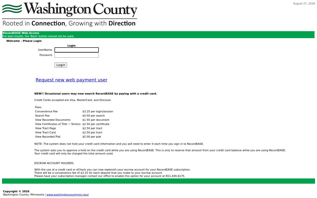
RecordEASE is Washington County’s gated recorder route for detailed abstract and Torrens land records. The county states that detailed online records cover 1984 to the present. After access, the system supports grantor, grantee, legal-description, and date searching, along with document, tract, certificate, and plat materials. Start from a known document or legal description and work backward through prior references. A grantor transfers an interest; a grantee receives one. Neither role alone proves that a party lived at the parcel.
The RecordEASE sign-in screen shows the gated route used for recorder research.
For records before the stated online period, use the Washington County Recorder’s public research room, deed books, tract cards, plats, and staff guidance rather than treating an online gap as a title conclusion. The recorder maintains abstract and Torrens systems, which organize land-title history differently. A focused request using the PIN, legal description, instrument type, parties, and year range is more useful than a broad request for every name tied to a street.
Cottage Grove Permit Records by Street
City permit and meeting records can add a dated project trail to an address. Cottage Grove ePermit allows a status search by record number and gives an address-search instruction: enter the street number and street name only, leaving off type, unit, and direction. Public results, where available, may distinguish a record type, status, project address, dates, applicant or contractor, and scope. The city does not state a beginning or ending coverage date, so an empty result is not proof that work never occurred.
The Cottage Grove Agenda Center provides a separate civic-document route. Search a street name, subdivision, project number, topic, date range, or category for planning approvals, road work, easements, and meeting packets. An agenda mention needs its surrounding packet or minutes and does not prove that every named person attended a meeting or lives nearby. For an identifiable city record that is not available online, a focused request can be sent through the city information-request channel.
Cottage Grove Street History Before Growth
Older Cottage Grove address work needs its own vocabulary. The area appears in rural and township records before becoming a village in 1965 and a city in 1974. The historic record describes a sharp building surge from 1958 through 1960, when 1,200 houses were built. A road may therefore appear first in a plat, a telephone volume, a rural-route reference, or a township record rather than under its current street form.
No official Cottage Grove renumbering table was found. Compare road centerlines, recorded plats, legal descriptions, older newspaper references, and directory headings instead of assuming a modern number was always used. The Minnesota Historical Society finding aid includes Cottage Grove telephone volumes and a separate Thompson Grove run for 1960 through 1992. Those historical listings can support dated street research, while the fuller collection context belongs with the Cottage Grove city directory materials.
Note: Preserve the historic place name, directory year, and printed heading when a result uses township, rural-route, or Thompson Grove language.
Cottage Grove Address Records by Street
Each address source answers a narrower question than a household directory. Parcel and tax systems identify land and displayed taxpayer information. Maps provide geographic context. Recorder instruments document land transactions. City materials can place a public project or meeting on a street. Historical collections can supply a dated listing or notice. Keep the source type and date beside every finding, because a tax owner, applicant, signer, or historical telephone subscriber may not be the current resident.
| Address-keyed record | Custodian | Street-level use | Access route |
|---|---|---|---|
| Tax parcel and statement | Washington County Assessor and Taxpayer Services | PIN, situs, tax, class, districts, and displayed owner or mailing data. | Property search, service center, or county contact. |
| GIS parcel map | Washington County GIS and Surveyor | Parcel geometry, address point, road context, and adjacent parcels. | ArcGIS viewer or county maps. |
| Deed, plat, or certificate | Washington County Recorder | Legal description, dated transfer, lot or block, and title context. | RecordEASE, research room, mail, or copy request. |
| Permit and planning file | Cottage Grove Building or Planning | Public construction or development record tied to a project address. | ePermit, city counter, or focused request. |
| Agenda packet | Cottage Grove City Clerk | Street, subdivision, road, project, or meeting reference in context. | Agenda Center or city request. |
| Polling geography | Minnesota Secretary of State and County Elections | Polling place and districts serving an address, not a resident list. | Poll Finder or Elections office. |
| Telephone directory or newspaper | MNHS, Washington County Library, and WCHS | Dated historical listing, notice, or street reference. | Library, historical society, or archive research. |
Parcel PIN and legal description are the strongest cross-system identifiers. Street spelling is useful, but it can change with a suffix, directional, historical locality, or project name. Where two sources conflict, retain both descriptions and ask the responsible office about the record rather than selecting the more convenient result.
Cottage Grove Parcel and Street Terms
Land and historical-directory terms can sound alike while describing different evidence. These short definitions help keep an address trail precise and avoid converting a record field into a statement about a household.
- Parcel or PIN
- A parcel is a tract of land shown in county records; its PIN is the county identifier that connects tax and map work.
- Situs address
- The physical address associated with the parcel. It can differ from the address where tax mail is sent.
- Plat
- A recorded map that lays out lots, blocks, roads, easements, or subdivision features.
- Criss-cross directory
- A reverse-style historical directory organized by address, useful for dated street listings when one survives.
For a disputed lot line, title question, or address change, rely on the recorder, survey information, and the recorded plat. A web map is a valuable research aid, but it does not replace the legal record.
Cottage Grove Street Election Geography
An address can also be checked with the official Minnesota Poll Finder to identify its polling place and election districts. That is geography, not a roster. Minnesota has no verified public name-only Cottage Grove voter lookup. A nearby address can fall in a different precinct or district, which is one reason that a street cannot be reduced to a single voter result.
Voter data has a separate controlled process under Minnesota Statutes section 201.091. A permitted request has a written-statement and use requirement, and the full list cannot be posted as a searchable internet database. Protected voters may have withholding, and Safe at Home participants use an alternate address system. A missing or alternate record should be left unresolved, not reconstructed from other sources.
Cottage Grove Privacy Along a Street
Address records are date-specific and purpose-specific. Parcel maps do not identify all people at an address. Recorded deeds and tax cards are land records, while permits and agendas describe public municipal records. Utility and delivery information are not a substitute for a public record, and confidential, sealed, or protected data remains unavailable. A current person should not be inferred from an old directory entry, an off-site tax mailing address, or a grantee’s name.
Minnesota’s Government Data Practices Act directs requesters toward public government data while allowing custodians to apply classifications. Ask for a known public document, parcel, date range, permit, or agenda item. Do not ask a city or county office to assemble a new list of everyone on a street. Corrections and copies belong with the custodian that holds the record.
Lawful use. Use address records for personal, lawful research and civic or family-history questions. Never use a parcel, map, or historical listing to stalk, harass, intimidate, or bypass an address-confidentiality program.